


22 October 2022
26739
2022-10-22 14:23
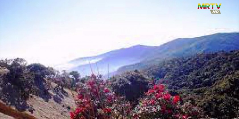
Most of the tributaries flowing into the Irrawaddy River from the west originated from Natma Mountain and the long-term survival of Ayeyarwady River mainly depends on Nat Ma Taung.
The Nat Ma Taung Mountain with its geo-peak is one of the highest in Southeast Asia, measuring 10,200 ft above sea level. It is the third highest mountain in Myanmar.
NatmaTaung also called Khaw-nu-soum or Kho nuam thung in Chin, also known as Mount Victoria.
Now with the name of NatmaTaung national park, preserving the natural environment and biodiversity and implementing the tourism sectors. Natma-taung National Park was established in 1994. The 279 square mile stretched National Park is situated in Chin State and it is comprised of Mindat Township, Kanpetlet Township, and Matupi Township.
Zi Na Man Aung pagoda on the peak which was erected on 28th March 1971 and the visitors can enjoy the view over the surrounding chin mountain ranges. Zi Na Man Aung pagoda is the highest above sea water in Southeast Asia, it is learnt.